CDE e-Portfolio - S3
Welcome to my CDE e-Portfolio! This space showcases the projects carried out during the Copernicus Master in Digital Earth. Each project reflects my journey in developing interactive maps, 3D visualizations, reports in Earth Observation (EO), combining creativity with technical expertise. Explore the projects below to see how I've applied digital solutions to real-world challenges.
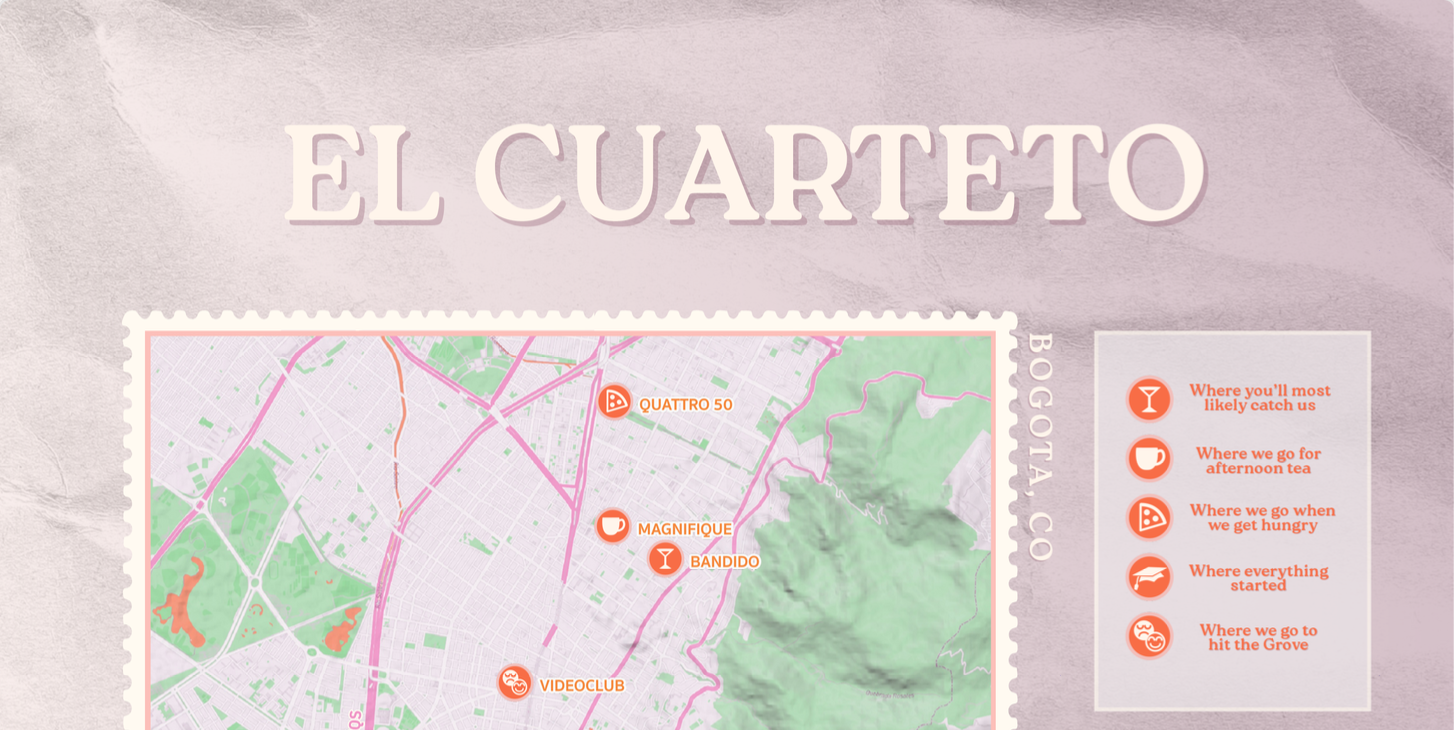
Unconventional Map - El Cuarteto
This project is the result of an unconventional mapping initiative inspired by my closest friend circle (El Cuarteto) and some of our favorite POIs in our hometown. Geography is not only about spatially locating coordinates but also about the stories and energy they hold. We are geographically separated but projects like this help keep us connected.
Sep 15, 2025
View Map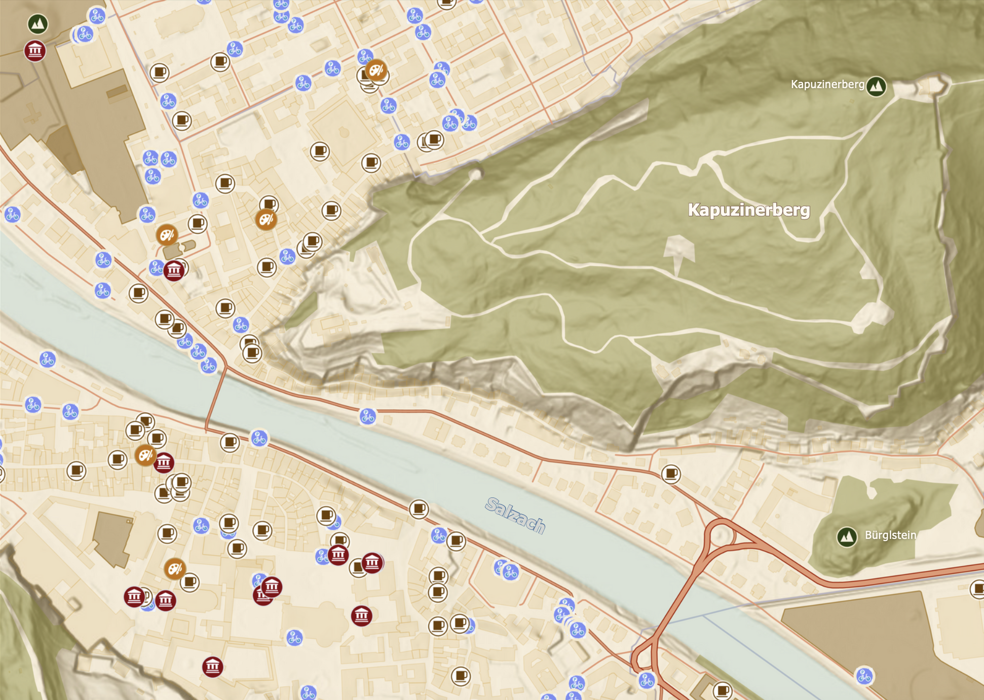
Topographic Map of Salzburg
A realistic topographic map of Slazburg showcasing art galleries, museums, cafes, bike parkings, along with near by parks, green areas, buildings and natural fetures as the river Slazach. The maps also illustrates the main roads, organized into three distinct categories.
Aug 22, 2025
View MapTransport Infrastructure - Czechia
This map presents the transportation infrastructure of the Czech Republic, including international and local airports classified as civil, military, or mixed-use facilities. It also highlights the country’s railway network and major roadways, providing a comprehensive overview of national connectivity.
Oct 16, 2025
View Map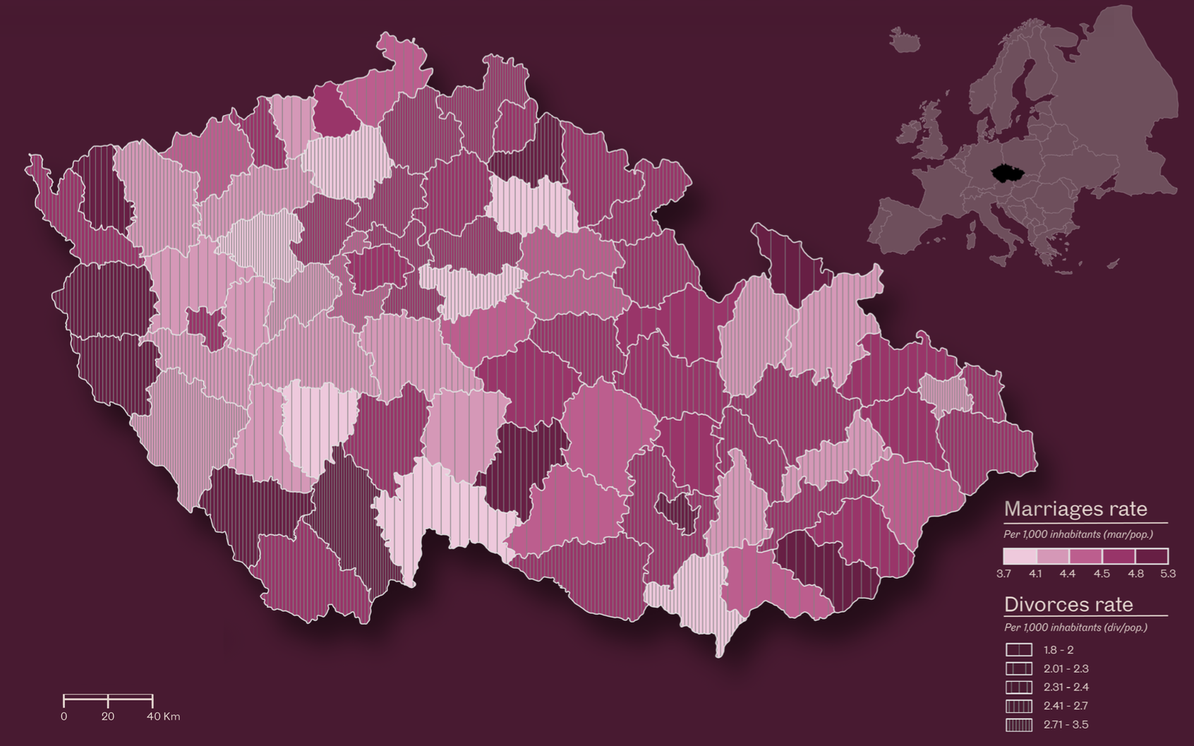
Marriages & Divorces - Czechia
A choropleth map illustrating the distribution of marriages and divorces per 1,000 inhabitants in the Czech Republic. Marriages are represented using color gradients, while divorces are depicted through hatching techniques, allowing for clear visual comparison between the two indicators.
Oct 23, 2025
View Map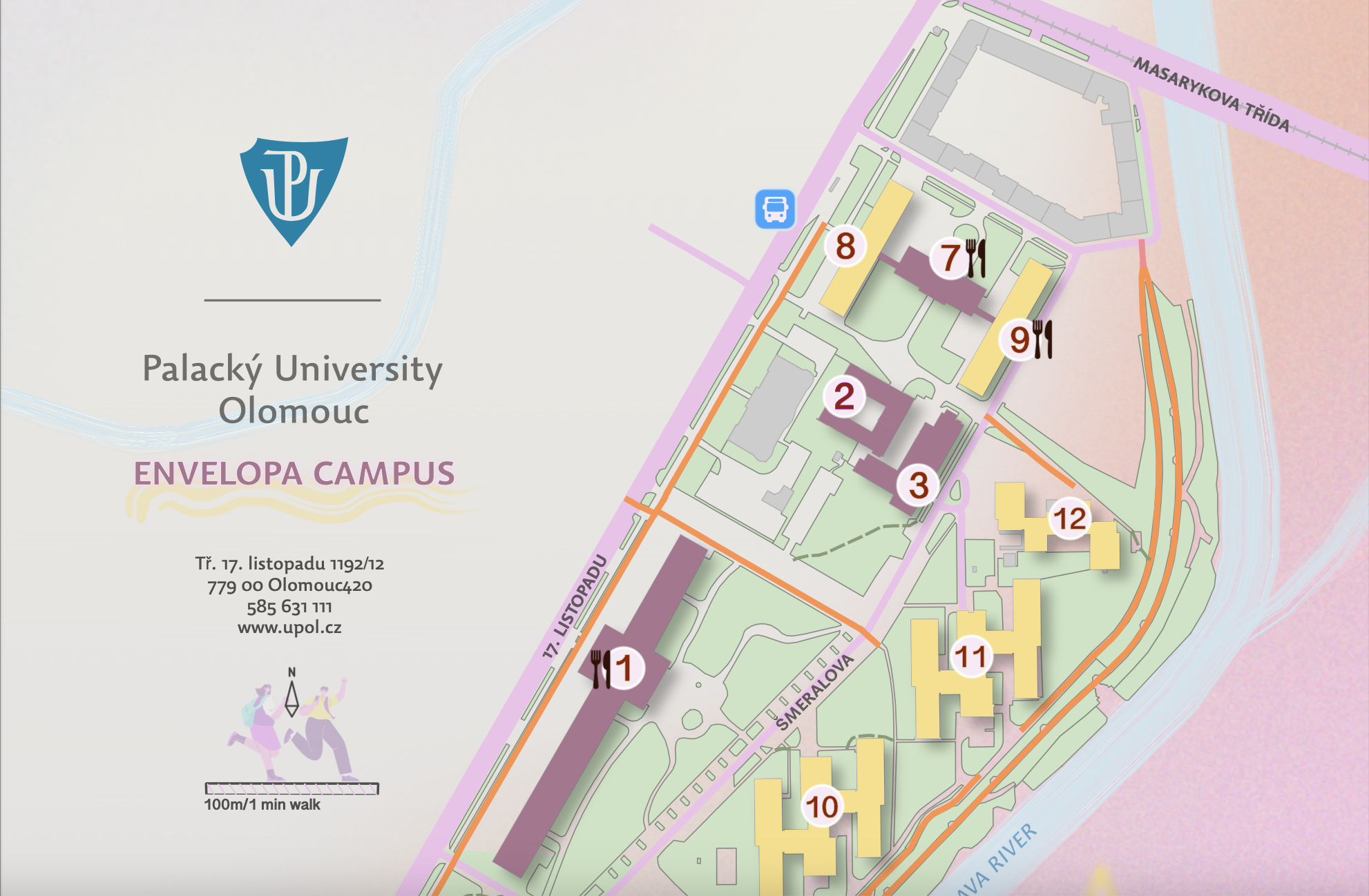
Envelopa Campus - UPOL
An appealing infographic of the Envelopa campus at Palacký University in Olomouc, highlighting key points of interest such as faculty buildings, dormitories, cafeterias, roads, and public transportation stops.
Nov 09, 2025
View Map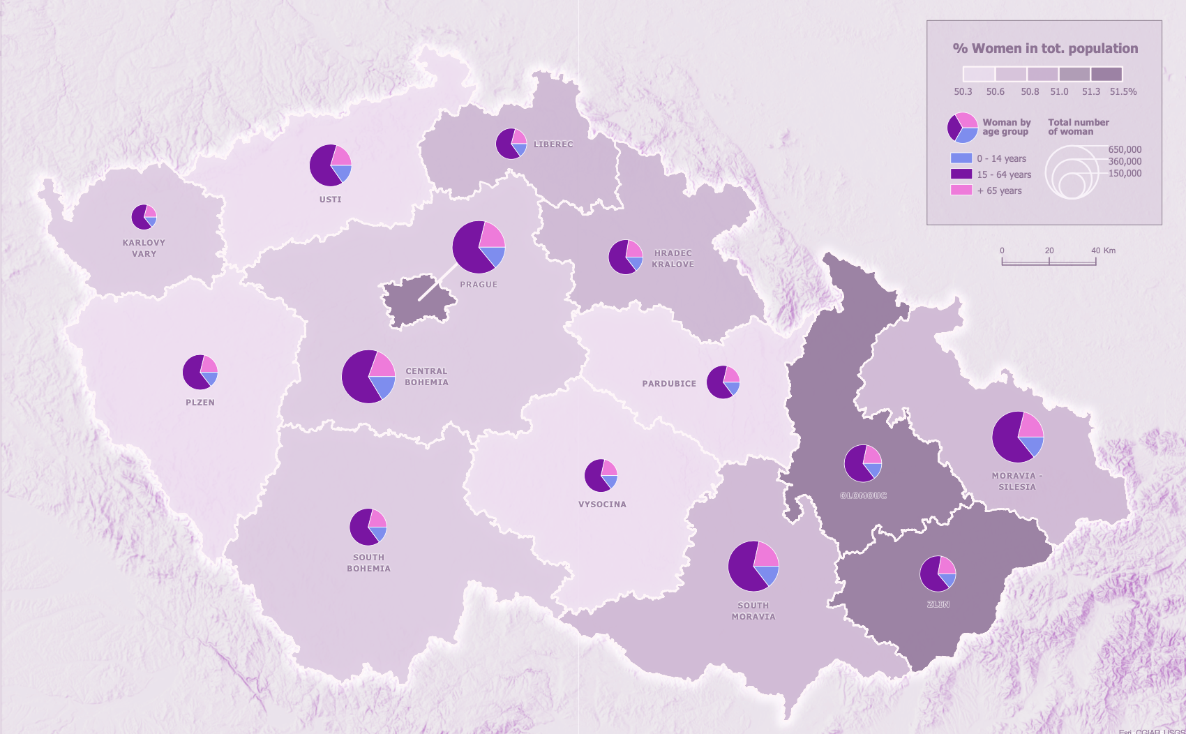
Female Population - Czechia
A map presenting the distribution of the female population by region in the Czech Republic, using three cartographic methodologies to illustrate different variables: the percentage of women in total population, the distribution of women by age group, and the total number of women.
Nov 06, 2025
View Map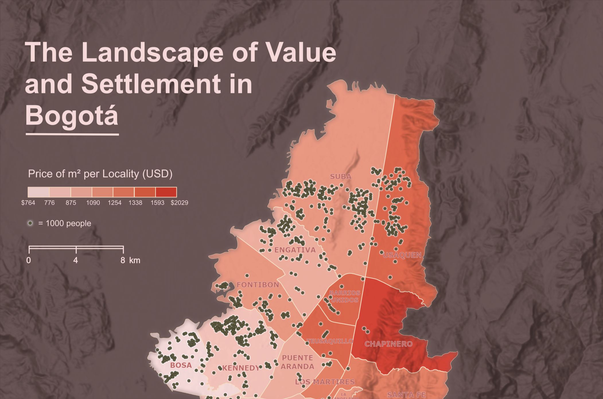
Value & Settlement - Bogotá
A spatial representation of household values in Bogotá in relation to residents’ settlement patterns. Housing prices are shown as relative values grouped by locality, while population distribution is expressed using a dot-density method, with each dot representing 1,000 inhabitants.
Nov 26, 2025
View Map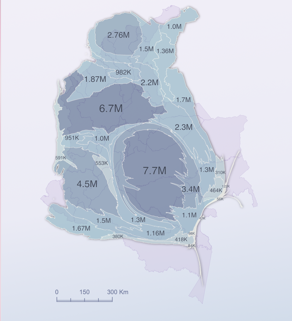
Colombian Population - Cartogram
This project presents a differently scaled view of Colombia, where the country’s geographic extent is distorted according to the population of each department. It offers a visually attention-grabbing cartogram that helps users understand the weight of population in contrast to territorial size.
Nov 16, 2025
View Map