CDE e-Portfolio - S2
Welcome to my CDE e-Portfolio! This space showcases the projects carried out during the Copernicus Master in Digital Earth. Each project reflects my journey in developing interactive maps, 3D visualizations, reports in Earth Observation (EO), combining creativity with technical expertise. Explore the projects below to see how I've applied geospatial solutions to real-world challenges.
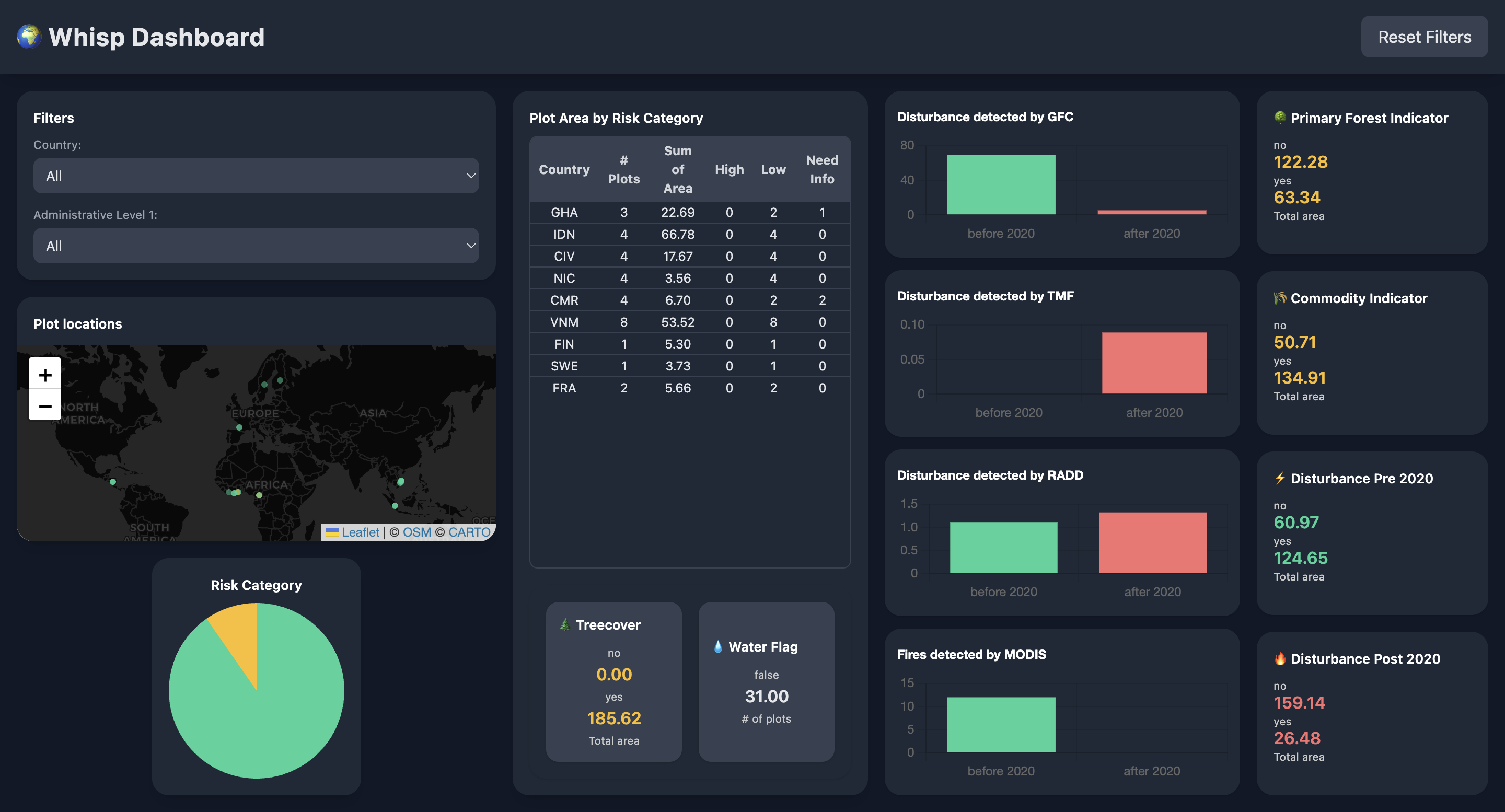
Digital Tools for EUDR Compliance and Risk Benchmarking - Internship
This report presents the internship work on developing the SELF-EUDR prototype, benchmarking deforestation risk platforms, and creating interactive resources for visualizing risk and environmental indicators.
Sep 15, 2025
View Project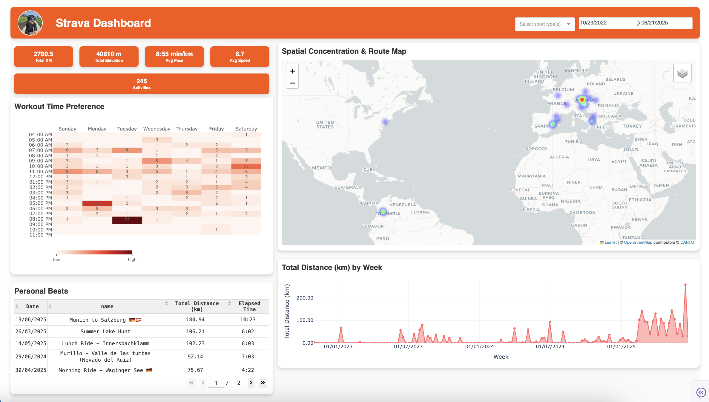
Interactive Strava Activity Dashboard - Jupyter Notebook
A Jupyter Notebook dashboard using the Strava API to analyze and visualize physical activity data. It provides interactive insights on workout patterns, performance metrics, and spatial activity distribution, helping athletes and fitness enthusiasts track progress and explore trends.
Aug 22, 2025
View Project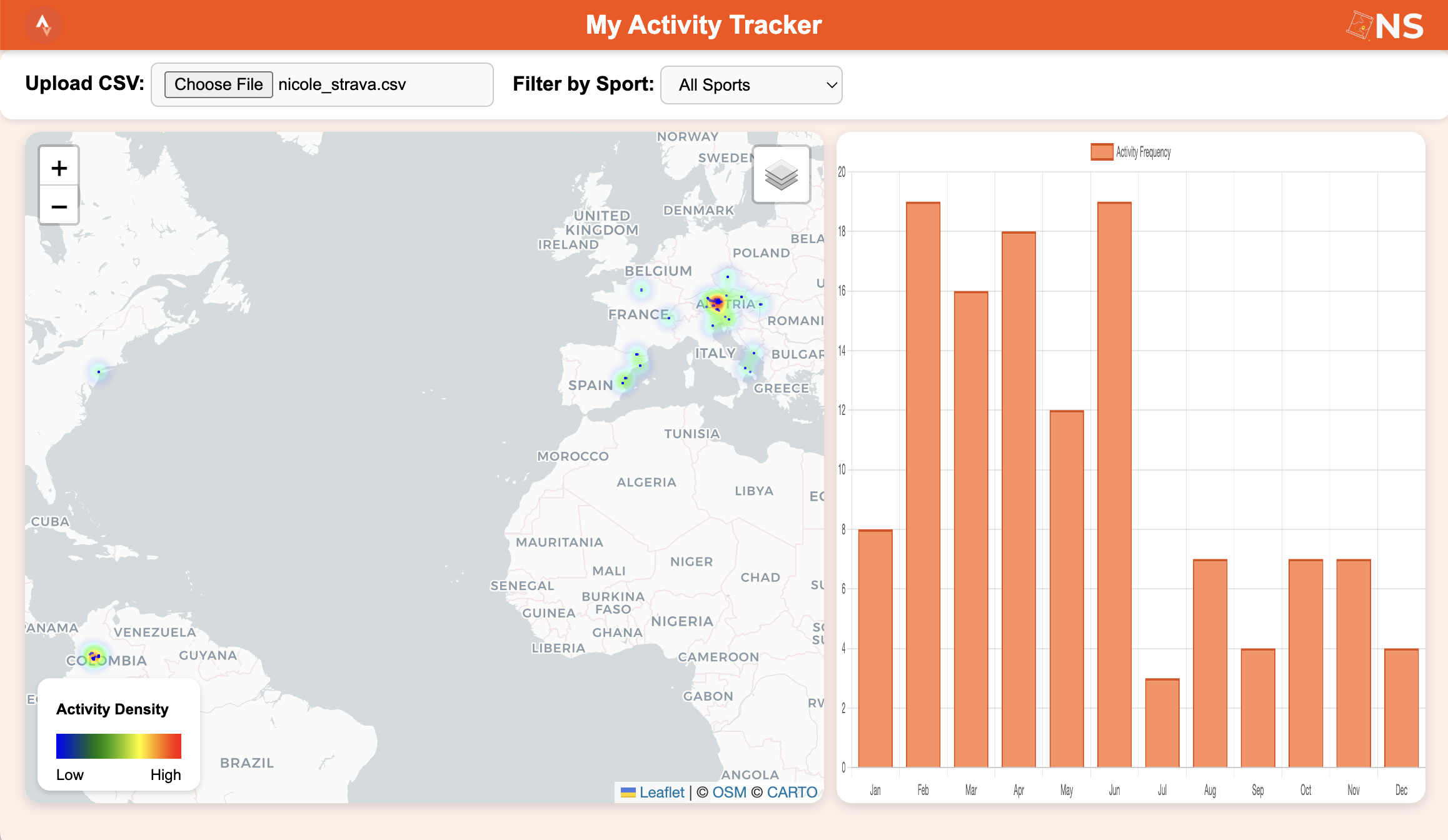
Strava Activity Tracker - Web App
An interactive web dashboard that visualizes Strava activities from a CSV export. Users can explore routes on a map, track performance metrics with dynamic charts, and filter activities by sport. Built with Leaflet.js and Chart.js, it offers a responsive, browser-based experience for athletes.
Aug 15, 2025
View Project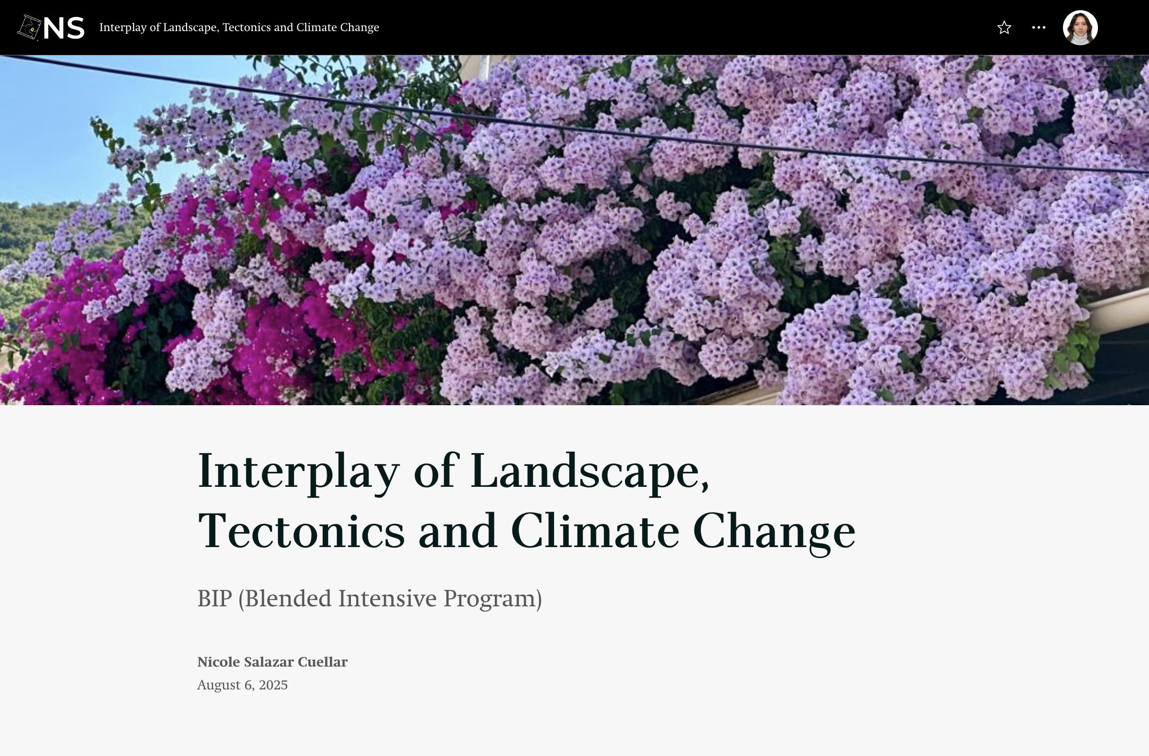
BIP - Interplay of Landscape, Tectonics & Climate Change
This report summarizes the BIP on Landscape, Tectonics & Climate Change in the Mediterranean, examining climate impacts on tectonic and coastal environments. It covers coastal erosion, shifting precipitation, and hazards, combining virtual learning and fieldwork for practical insights into landscape evolution and adaptation.
Jul 30, 2025
View Report
SS - Techniques for 3D Modelling & Visualization of Digital Twins
This StoryMap shares insights from the NexCity Summer School, showing how geospatial technologies and deep learning support urban digital twins. It explores data workflows, solar irradiation studies, and real-world applications to advance smarter, sustainable cities.
Jul 21, 2025
View Report