CDE e-Portfolio - S1
Welcome to my CDE e-Portfolio! This space showcases the projects carried out during the Copernicus Master in Digital Earth. Each project reflects my journey in developing interactive maps, 3D visualizations, reports in Earth Observation (EO), combining creativity with technical expertise. Explore the projects below to see how I've applied geospatial solutions to real-world challenges.
Salzburg Explorer: Interactive Guide to Cafés, Culture & Peaks
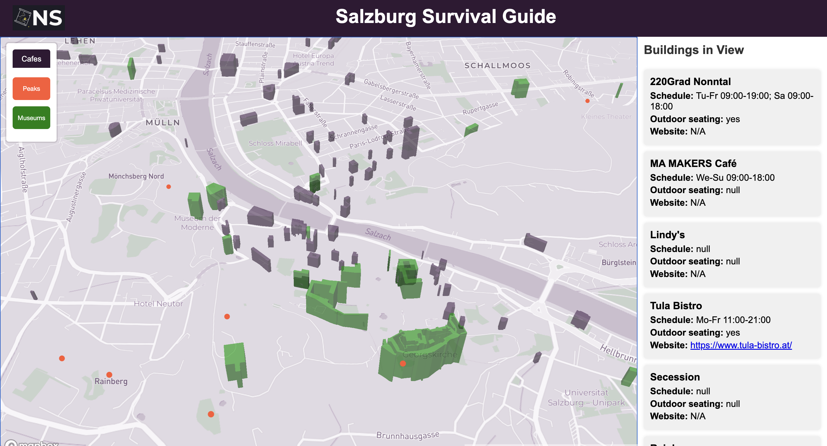
An interactive web map displaying cafes, museums, and hiking peaks within a 2 km radius of Salzburg's city center. Users can explore these points of interest and view detailed information in a right-side panel, dynamically updating based on the map's zoom extent.
Feb 26, 2025
View Project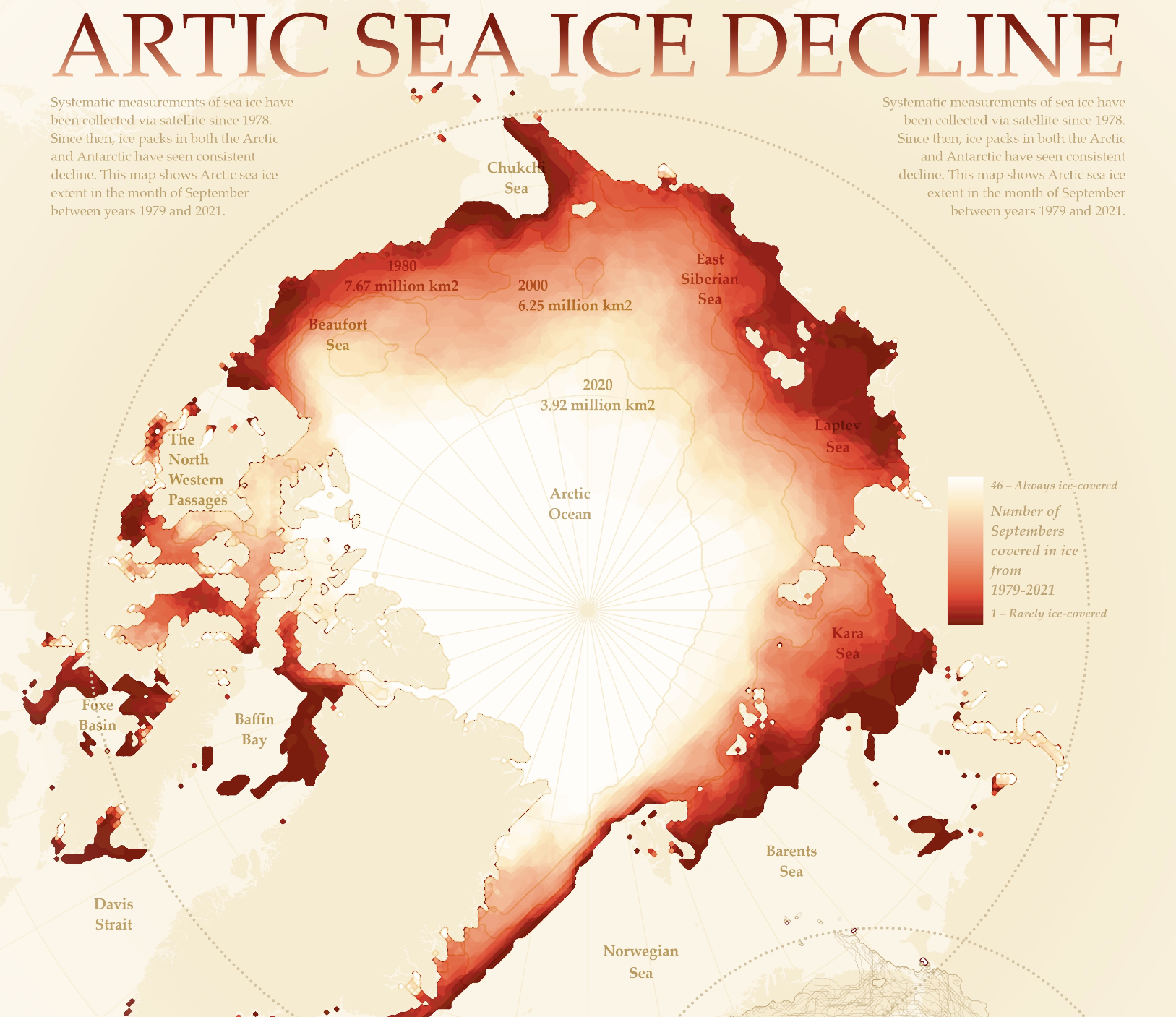
Arctic Sea Ice Through Time: A Visual Exploration
A visually compelling, data-driven cartographic piece showcasing the decline of Arctic sea ice over time. Using color gradients, visual hierarchy, and key insets the map highlights the urgent impact of climate change.
Nov 19, 2024
View Project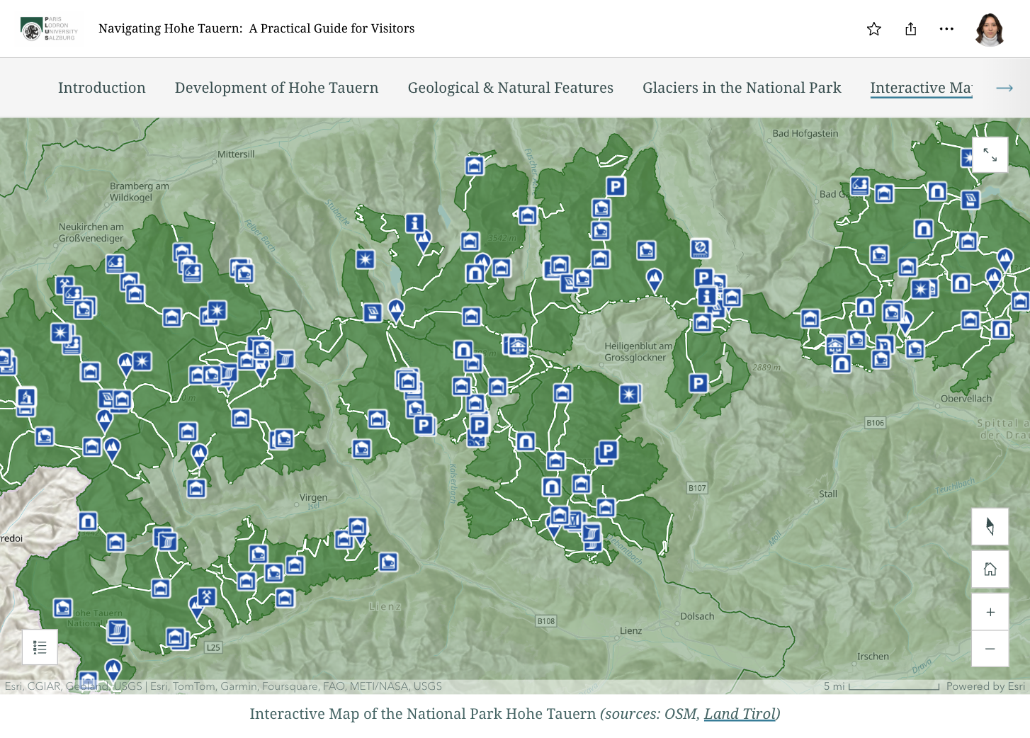
Navigating Hohen Tauern: A Practical Guide for Visitors
An interactive story map showcasing the evolution of Hohe Tauern National Park, highlighting its geology, glaciers, and key landmarks. Designed for tourists, it blends visuals, information and an intuitive layout for an immersive exploration experience.
Feb 28, 2025
View Project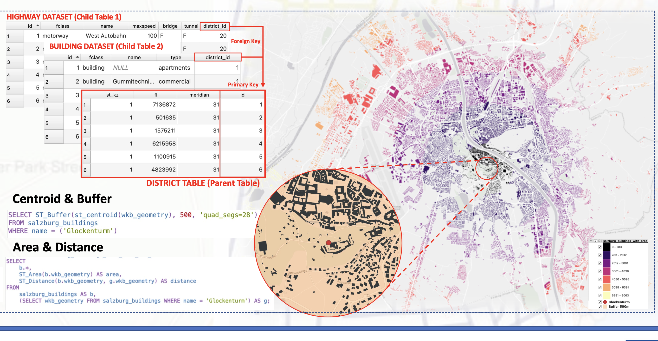
Spatial Data Management & Modeling - Poster
This project explores the power of spatial databases in GIS, utilizing PostgreSQL and PostGIS for efficient data management, analysis, and integration. It examines spatial queries, database structuring, and the role of spatial databases in enhancing geospatial workflows and decision-making.
Feb 24, 2025
View ProjectEye Tracking Experiment: Assessing Arctic Ice Loss Maps
This study assessed the effectiveness of a map depicting Arctic sea ice loss from 1979 to 2021. Using a color gradient from light tones to deep reds, it highlighted areas of maximum impact. The research evaluated whether the map’s message was clear and understood by its audience.
Nov 25, 2024
View Project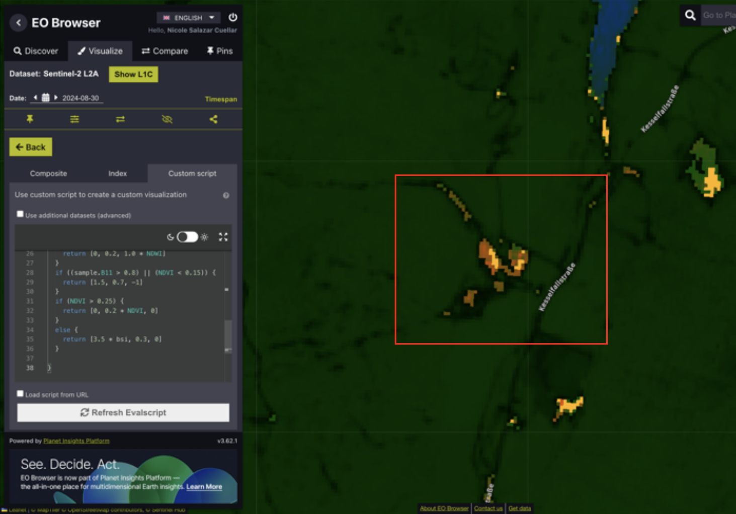
Soil Mass Movement Detection Using EO-Browser
Automated detection of soil mass movement using Sentinel-2 imagery through EO-Browser. The utilized script analyzes NDWI, NDVI, and B11 values to identify landslides and movement vectors, aiding disaster management in Kaprun, Salzburg, after severe August 2024 rainfall.
Feb 09, 2025
View Project